Fall can be fickle. It’s a season of transition… or, as I like to say, a shoulder season.
Storms with dual personalities roll up the coast, teasing us with their warm side only to whip around with a wallop of winter as they leave town.
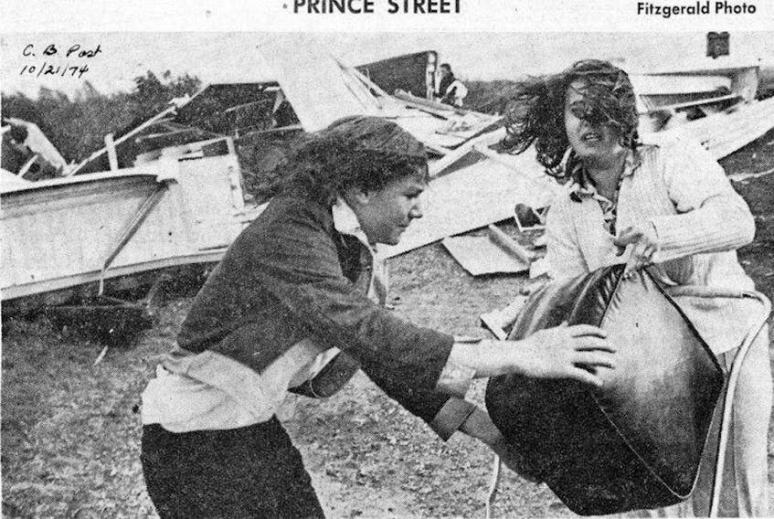
When the fall storms start to roll up the eastern seaboard, many Cape Bretoners recount the story of the October storm that struck in the fall of ’74. It came quickly and left the very same way.
Just after midnight on Oct. 20, it was mostly cloudy and the barometric pressure at the North Sydney weather station was 1008 millibars. The temperature was plus 4 and the wind was light. The rain started shortly after sunrise. At noon, it was 14 C and the wind had come around to the south with gusts to 100 km/h. The station pressure fell to 970 millibars.
Between noon and 6 p.m., the average wind speed didn’t drop below 50 km/h; it peaked at 3 p.m. with a sustained speed of 90 km/h and gusts were clocked at 130 km/h. By 6 p.m., the temperature was –1 C, the wind had come around to the northwest and the pressure was rising; in less than 60 minutes the rain showers had switched over to snow. Two hours later, there wasn’t a cloud in the sky.

It was a very different storm on mainland Nova Scotia. Cold air funnelling into the backside of the storm produced record snowfalls: Halifax residents were shovelling out from 39 cm of snow, close to 30 cm fell throughout the Annapolis Valley, with 20 cm along the south shore.
While the storm didn’t have a name, it checked all the boxes to qualify as a weather bomb. By definition, a weather bomb is an extra-tropical cyclone characterized by a central barometric pressure drop of at least 24 millibars in 24 hours. In this case, the pressure fell almost 40 millibars in 12 hours.
If you lived in Nova Scotia at the time, you no doubt have a story or two to tell about the October storm of 1974.
Where were you when the storm blew through? You can send your stories, comments or photos to weatermail@weatherbyday.ca


